IN NEED OF A SURVEY FOR YOUR PROJECT?
ALTA/NSPS LAND TITLE SURVEY
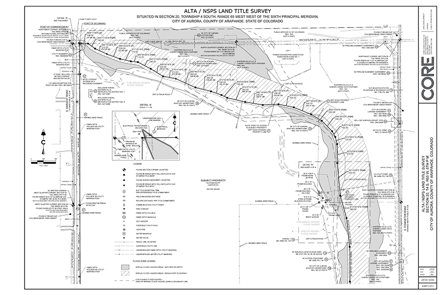
An ALTA/NSPS land title survey is a detailed boundary survey and Improvement Survey Plat (ISP) that is guided by standard requirements agreed upon by the American Land Title Association (ALTA) and the National Society of Professional Land Surveyors (NSPS). These requirements assure that any survey of real property and the associated map of record are acceptable to a title company for insuring title to said real property. ALTA surveys require the use and examination of a property's title commitment and show all plottable easements upon the property. ALTA surveys utilize a list of optional survey responsibilities that are agreed upon by the client and surveyor.
TOPOGRAPHIC SURVEY
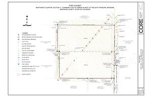
A topographic survey is a map over a portion of land that depicts natural and man-made features including trees, vegetation, creeks/rivers, buildings, improvements, and fences. Horizontal and vertical components are mapped in the field and presented in a map with contour lines and spot elevations. Topographic surveys are often required for the design of future site improvements and used by engineers, architects,and government agencies. Topographic surveys typically accompany boundary surveys.
IMPROVEMENT LOCATION CERTIFICATE (ILC)
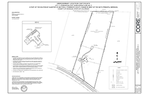
An Improvement Location Certificate (ILC) is an inspection of a property or parcel of land by a Professional Land Surveyor (PLS), to determine approximate location of property lines and improvements that exist on the premises, and to disclose apparent encroachments. ILCs are primarily used for real estate closings or for construction documents and are a cost-efficient, quick way to determine property issues that should be addressed through a more substantial Land Survey Plat (LSP) or Improvement Survey Plat (ISP). ILCs are NOT surveys. They are certificates to specific terms and do not locate exact boundaries or establish property lines. They cannot be legally relied upon for the establishment of future buildings, additions, fences, and other improvements.
LAND SURVEY PLAT (LSP)
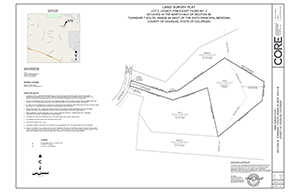
A Land Survey Plat (LSP) depicts information developed by a monumented land survey of a property and describes the survey monuments that were found or set upon the property. These surveys will typically disclose any apparent or recorded rights-of-way and easements as researched or observed. These surveys establish boundary lines and corners of a property and disclose conflicting boundary evidence and possible encroachments.
IMPROVEMENT SURVEY PLAT (ISP)
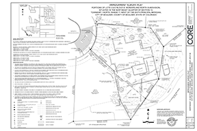
An Improvement Survey Plat (ISP) starts with an LSP but includes the location of all structures, visible utilities, fences, hedges or walls situated on the described property and within five feet of all boundaries of that parcel. ISPs will also disclose any apparent or recorded rights-of-way and easements as researched or observed. These surveys establish boundary lines and corners of a property and disclose conflicting boundary evidence and possible encroachments.
FEMA ELEVATION CERTIFICATE
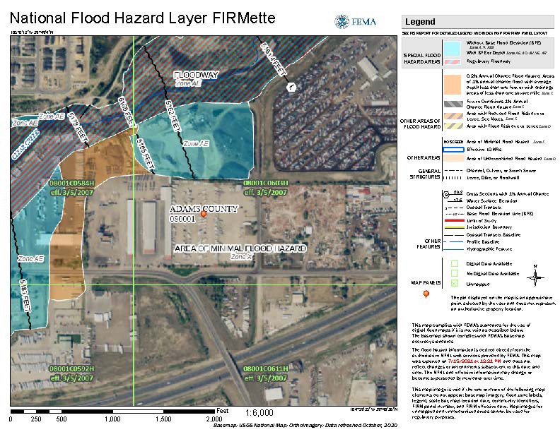
A FEMA elevation certificate provides information about your property’s flood zone, building characteristics, and lowest elevation point. This information is used by insurance companies to calculate a property's flood risk. Elevation certificates are requested by mortgage and title companies as well as individual homeowners to determine how a property or any of its improvements relate to base flood elevations depicted on FEMA Flood Insurance Rate Maps (FIRM). Elevation certificates may be used to determine flood insurance rates for a particular property.
DRONE MAPPING AND IMAGERY
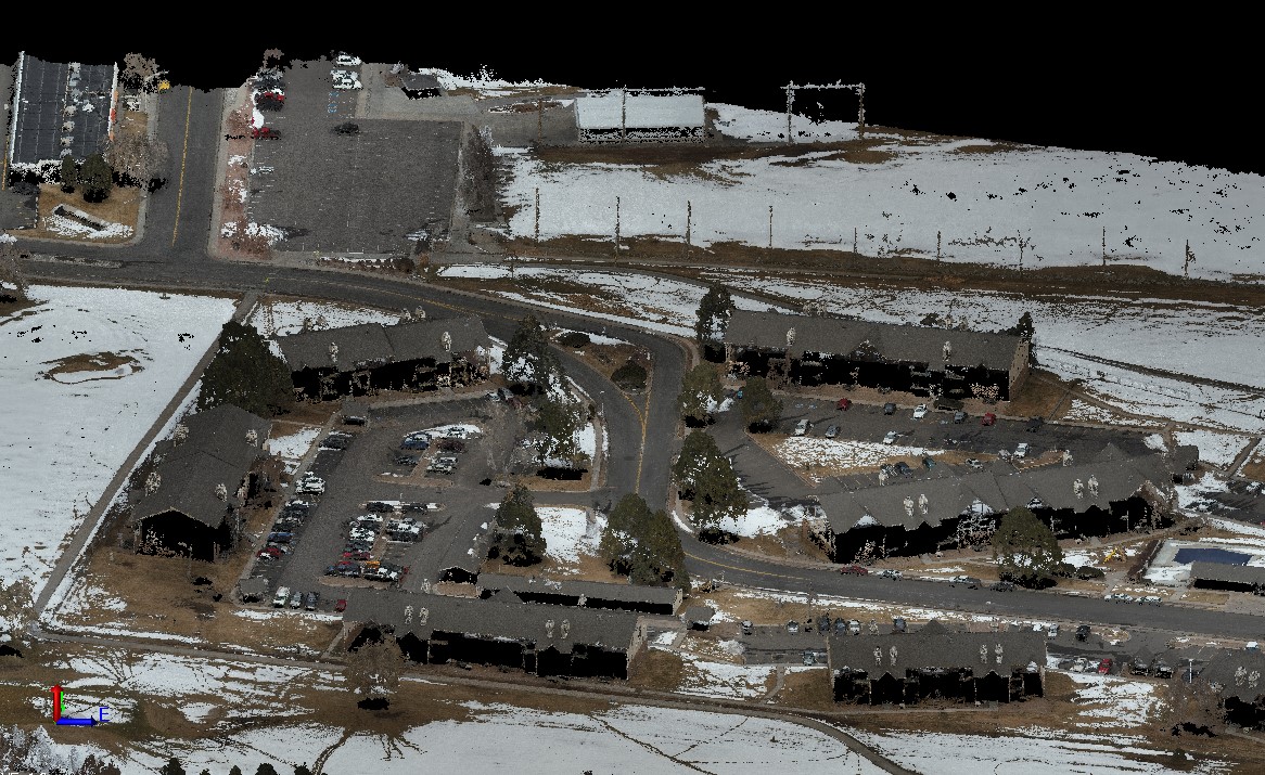
Unmanned Aerial Vehicle (UAVs) commonly known as “drones” are used to scan mapping data and collect high resolution imagery upon and over various types of terrain. UAVs use LiDAR scanning to collect point clouds of topographic features and can be post-processed into digital terrain maps and various types of surveys. Drone mapping and imagery is useful for design surveys, topographic mapping, quantity calculations, construction monitoring, and as-built documentation.

ABOUT US
CORE Consultants, Inc. (CORE) is a professional services firm with offices in Englewood and Winter Park, Colorado offering civil engineering and land surveying services. The team specializes in land development, energy, and public infrastructure projects throughout the state and beyond.
Founded in 2014, CORE has created a unique culture that empowers our people to thrive at home, at work, and in their community. Our focus on balance has resulted in happy employees, happy clients, and thriving communities. To learn more about CORE, visit liveyourcore.com.
INQUIRIES
OFFICES
ENGLEWOOD
3473 South Broadway, Englewood, CO 80113
303.703.4444 | mktg@liveyourcore.com
WINTER PARK
78967 US Highway 40, Winter Park, CO 80482
970.564.3900 | mktg@liveyourcore.com